Moulton Barn Grand Teton National Park

Grand Teton Photography Trip Planning

Grand Teton Photography Trip Planning

Moulton Barn Grand Teton National Park Grand Teton Photography Trip Planning
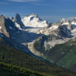
Moulton Barn Grand Teton National Park  #67219  Purchase

This post is the first in an ongoing series of articles intended to help landscape and nature photographers plan photography trips to big locations on a small budget.

Photography in Grand Teton, or any National Park, can be a very rewarding experience. It can also be a disappointing exercise in frustration. Even the most meticulous planning is not a guarantee of success. It all depends on what your goals are, and how much time you have available.

In this post, I’ll be offering some planning tips and suggestions which can help increase your chances of success during a Grand Teton photography trip. Whether the results are better vacation photos or portfolio-quality images, they’ll also help you obtain a more enjoyable and memorable experience.

Planning A Grand Teton Photography Trip

Theoretically, you can spend as little as a day in the park and come away with a few good photos. In reality that probably won’t happen. So I would recommend at least three days to concentrate on one, or maybe two locations. A better time frame would be a week. For a comprehensive trip to include all of the park’s highlights, at least two to three weeks would be ideal.

Make sure you have as much time available to meet your goals. And make those goals realistic, don’t expect to create portfolio-grade images every morning and evening during your stay. It’s incredibly unlikely that you will have excellent light to work with during every golden hour photo session. On my last trip, I spent two weeks in the park and had only one evening and two mornings of decent light.

Of course, it’s also a silly notion to think that planning on just one trip to Grand Teton you’ll come away with award-winning images from every corner of the park. Just like you can’t go to the grocery store and expect to buy all the food you’ll ever need if your lifetime. You’ll need to return again and again.

Learn to go with the flow, relax, get to know, and interact with your subject matter. If you only come away with one or two good photos that’s great, you can always return another time. Good photography is about much more than grabbing trophy images, it’s a lifetime learning journey that should be savored, not rushed.

Guided Tour Or Solo

Once you determine how much time you’ll have available the next thing you’ll need to decide is whether to go with an established workshop/photo tour or do the trip on your own. There are many advantages and disadvantages to either option.

Photo Tour/Workshop Advantages:
-Led by a seasoned professional photographer with intimate knowledge of the park and the opportunity of learning new techniques from a pro.
-Meals, lodging, and transportation usually included
-Being part of a group dynamic

Photo Tour/Workshop Disadvantages:
-Limited freedom to photograph where and when you want
-Daily schedules can be very rigid
-Travel times and distances from lodging to locations can be great
-Cost can be prohibitive

Solo Photo Tour Advantages:
-Unlimited freedom, photograph where you want when you want
-Ability to lodge or camp where you choose, cutting down on travel time to         locations
-Huge cost savings

Solo Photo Tour Disadvantages:
-Extra research needed to find the best locations
-Finding lodging on the fly daily can be difficult
-Lack of assistance from a leader or group members
-No one to share ideas or experiences with

During my entire career as a professional photographer, I’ve traveled mostly solo. I love the freedom and flexibility associated with this mode of travel. And I know for certain that I’ve been able to get better photos because of it. So this is the mode I’ll be giving tips on in this post.

Grand Teton Photography Trip Planning: Seasons

Many photographers consider autumn to be the best. However,  Grand Teton National Park offers spectacular photographic opportunities in all four seasons.

Grand Teton National Park in winter Grand Teton Photography Trip PlanningThe Teton Range in Winter #4660  Purchase

Winter:  Planning a winter photography trip to Grand Teton requires more preparation and gear. In winter Teton Park Road is closed to vehicles, as is the popular Schwabacher’s Landing. Antelope Flats and Mormon Row Roads are also inaccessible. However, all the viewpoints along Highway 191/89 from Jackson to the Flagg Ranch in the north are open, including the famous Oxbow Bend overlooks. Snowshoes and cross-country skis are an excellent option to access some of the easier areas of the park.

Most of the lodging and services in the park are also closed for the season. Lodging options are mostly in the Jackson area in winter, and camping is nearly nonexistent with just a few spots open in the Shadow Mountain area. With temperatures that can dip down to -30º you won’t have much company. But with the right weather and lighting, you’ll come back with some rare winter images of the park.

Spring:  Since the Teton Valley sits at an altitude of just over 6000′ winter conditions can last well into spring. May would be about the earliest I would consider visiting for spring photography. Late May through June is the best time to visit to see wildflowers. During this time many areas of the valley are blanked with brilliant yellow balsamroot and blue lupines, to name a few.

Antelope Flats and Gros Ventre (pronounced “Grow Vaunt”) roads, along with Pilgrim Creek Road near Colter Bay are among the best areas for spring wildflowers. Most of these areas are also wide open for including the snowy Teton Range as a dramatic backdrop for compositions.

Wildflowers Grand Teton National Park Wyoming Grand Teton Photography Trip PlanningWildflowers Grand Teton National Park #52086  Purchase

Summer: This is the high season for tourism in the park, and possibly one of the most challenging for photographers. This is not only because of having to deal with crowds but also because of weather conditions.

During the height of summer, high-pressure ridges can create beautiful warm sunny weather, which unfortunately keeps the sky free of clouds. Most photographers consider blank blue skies and gray rainy days as some of the worst conditions to work with. With global warming in full swing, these conditions can last well into September.

Along with those warm sunny days comes the yearly threat of wildfires. In recent years the park’s blue skies are often hazy with thick blankets of smoke. Another consideration of summer photography is that as the season progresses the Teton Range gradually loses its white cloak of snow. I don’t think I’m alone in feeling that snowy mountains look more attractive than bare rock.

Fall:  This is arguably the most popular season for photographers in Grand Teton National Park. Although the crowds of tourists and vacationers are mostly absent, there are now throngs of photographers to take their place. And for good reason. In a good year, the changing colors of aspens, cottonwoods, and willows can be as outstanding as autumn in New England.

In addition to the lively colors of foliage, the changing seasons bring back storms that not only clear the air but also dust the range with a fresh coat of snow. Quite possibly some of the most sought-after national park images in the country are those of the Teton Range in full autumn color after a snow storm.

Grand Teton National Park Wyoming Grand Teton Photography Trip Planning
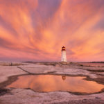
Sunset over the Teton Range #3966  Purchase

Grand Teton Photography Trip Planning: Lodging

Location, location, location. It’s all about location. And Grand Teton is no exception, it’s a big park with many great locations spread throughout it. Generally, you’ll have time to photograph only one location during the morning or evening golden hour. By the time you can reach the next spot the light will most likely have faded. And remember this isn’t a race or contest, slow down and appreciate where you are!

The closer you stay to your subject matter the better chance you have of being in right place at the right time. And you will be more relaxed and focused when you get there.

Absolutely nothing is worse than planning on being at a certain spot before sunrise than being late because of hitting the snooze alarm one last time and then having a long drive ahead. Stopped for speeding, or worse, hitting a moose in the dark during your haste? Ughh!

No matter where you stay, be it in a national park or forest service campground, or a motel or resort, be prepared to make reservations well in advance of your trip, if possible. Even in the shoulder seasons vacancies in lodging and campgrounds can be difficult to find. Popular campgrounds will fill by early morning. Research and plan ahead. It’s no fun driving around in the dark after a long day trying to find a place to sleep.

In the Town of Jackson:  If you crave luxury and have deep pockets then look no further than the town of Jackson. Some of the most opulent hotels and resorts in the West are in this town, as are many chain and mom and pop motels. However, be aware that all of them will have a considerably higher price due to their location.

Also, keep in mind that distances from the town of Jackson to many of the most scenic park locations can be anywhere from 15-35 miles. Not a terribly long drive, but back and forth to a motel over several days can really add up. And don’t forget that ideally, you’ll need to be at your desired location before sunrise and until after sunset. So you won’t be sleeping in that expensive bed for very long.

Shadow Mountain Dispersed Camping Area  Bridger Teton National Forest
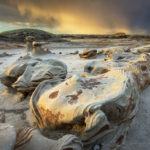
Shadow Mountain Dispersed Camping Area #67195  Purchase

In Grand Teton National Park:  There are seven lodging options within the park boundaries. These range from rustic cabins and ranches all the way up to the full-service luxury hotel of the Jackson Lake Lodge. Depending on where in the park you want to orient your photography efforts, these facilities can put you just a few minutes from some of the most dramatic vistas in the park.

There are five official front country campgrounds in the park with varying amenities. At the time of this writing, none of them are available for advance reservations. Most of them will fill to capacity before 10:00 a.m. Jenny Lake is one of the best and most sought-after campgrounds. If you choose Jenny Lake campground be prepared to line up for a site well before sunrise, it routinely fills by 6:00 a.m.!

Bridger-Teton National Forest: There are several national forest campgrounds outside the eastern boundaries of the park. These include a couple on Gros Ventre Road and U.S. Highway 26-287.

In my opinion, the most ideal national forest campsites are in the Shadow Mountain camping areas of Bridger-Teton National Forest. This area is in an ideal location just outside of the eastern middle edge of the park. These sites are always my first choice when visiting the park. I know of at least one site here which has an incredible elevated view of the entire Teton Range and valley.

Camping in the Shadow Mountain area is free on a first-come-first-served basis. Stays are limited to five consecutive nights. However, it is primitive camping with only vault toilets and no running water. In addition, parts of the roads can be very difficult to negotiate, high clearance is advised and some can be impassable to trailers. As with everywhere else in the park vicinity, these sites fill up early.

Grand Teton National Park Wyoming
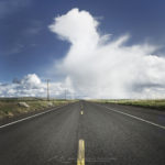
Highway 191 Grand Teton National Park #49386  Purchase

Fees, Passes, Provisions, Cell Signals

The entrance fee to Grand Teton National Park is currently $35 for a private vehicle and is good for seven days. An annual pass exclusive to Grand Teton National Park is $70. Note that both of these passes are good only for Grand Teton, they do not carry over to neighboring Yellowstone National Park.

Consider an America The Beautiful annual pass if you photograph in many national parks and federal recreations areas throughout the year. This pass costs $80 and is good for National Parks, BLM lands, National Forests, and more.

Various amenities like gas, groceries, showers and laundry services are available in several areas of the park. However, if you are on a budget plan to make a trip to Jackson to stock up on supplies. Park concessioners charge a premium for their goods. Although sometimes the cost of driving back to Jackson is more than an inflated price for goods in the park.

Grand Teton is one of the few national parks where you can get a decent cell signal in most areas. In the vicinity of visitor’s centers and lodges, you should be able to receive a signal strong enough to surf the web and transfer small files. Further out it will probably be only one or two bars strong.

In the next post, Grand Teton Photography Locations we’ll go into detail about how and when to photograph specific locations in the park.

Thanks for reading, feel free to share this post with your friends and colleagues!

Oxbow Bend sunrise Grand Teton National ParkOxbow Bend Sunrise Grand Teton National Park #67686  Purchase

Ever wonder what it’s like photographing landscapes and nature for a living? Check out my blog post:
What is it like to be a Professional Landscape Photographer?

All photos appearing in Grand Teton Photography Trip Planning are available for Commercial Licensing and Fine Art Prints. Click on any image to purchase, or contact me for more info!

Want to learn more? Take your Creative Photography to the next level with  Private Instruction and Guided Photo Tours.

Planning a Grand Teton Photography Trip

Yellowstone Falls Sunrise

Trip Update: Grand Teton Yellowstone

Trip Update: Grand Teton Yellowstone

Sunrise at Oxbow Bend, Grand Teton National Park Trip Update: Grand Teton YellowstoneOxbow Bend Grand Teton National Park  #67699  Purchase

When I announce my planned list of locations at the start of a lengthy photo tour I always stress the subject-to-change factor. Now that I’m over eight weeks into this trip it’s very apparent that factor has long ago come into play.

For example, the Grand Teton Yellowstone segment of this trip was originally going to last for around 5-7 days. However, the abundance of subject matter, changing seasons, and weather patterns extended my stay to nearly three weeks! When I return to the office I’ll be posting more details on these two iconic locations. Suffice it to say these parks were a definite change of pace from the quiet solitude of backpacking in the Sawtooths and Winds. I’ve now had my fill of park traffic jams, and crowds of selfie-obsessed young women!

Great Fountain Geyser Yellowstone National Park Trip Update: Grand Teton YellowstoneGreat Fountain Geyser Yellowstone National Park   #67744  Purchase

It’s also apparent that I most likely will not be continuing to the Canadian Rockies. After Leaving Yellowstone National Park I’ll be making my way up the Rocky Mountain Front Ranges into Glacier National Park. This will probably be the final destination for the trip. Since by the time I arrive fall color should be close to peak, and I’ll be working hard to take advantage of it.

Moulton Barn Grand Teton National ParkMoulton Barn Grand Teton National Park   #69710  Purchase

*The photos appearing on this post are quick on-the-road edits. However, they will be reprocessed and made available for sale when I return to the office.

*Please note, due to being out of cell or WiFi range for most of this trip I may not be able immediately to respond to any licensing requests or blog comments. Print orders that are placed while I’m away on this trip will not be shipped until I return to the office. Thank you for your patience and understanding!

Yellowstone Falls Sunrise Trip Update: Grand Teton YellowstoneYellowstone Falls Sunrise  #67940  Purchase

Island Lake Wind River Range Wyoming

Trip Update: Wind River Range

Trip Update: Wind River Range

Island Lake and Fremont Peak, Bridger Wilderness, Wind River Range WyomingIsland Lake Wind River Range Wyoming #66386  Purchase

I’m wrapping up nearly three weeks weeks of photography in the main segment of my photo tour, the Wind River Range of Wyoming. This part of the trip was a major undertaking for me. Hiking and photographing in the Wind River Range is quite unlike the Sawtooth Mountains of Idaho. The Sawtooth’s were three mainly moderate length trips at around 18 to 25 miles each, at 8000′ elevation. The trips in the Wind’s however were about 35 to 40 miles each. Trailheads were  starting at 9500′, with trails eventually reaching 11,500′ elevation. I’m glad I acclimated to higher altitudes in the sawtooth’s first!

Titcomb Basin. Wind River Range WyomingTitcomb Basin Wind River Range  #67957  Purchase

Unlike previous visits to the Wind’s there was no sign of major wildfires. While the weather was mostly beautiful summer weather, I did experience several instances of exciting evening and morning light.

While in the Wind’s I also continued experimenting with some night photography. I’m new to this genre of photography, but so far I’m finding it very enjoyable. Although I’d much rather being catching some sleep after a long day of hiking, photographing and swatting mosquitoes!

Now that the busy Labor Day Weekend is over I can safely venture into the next part of the trip. This includes Grand Teton and Yellowstone National Parks, followed by the Beartooth Highway.

Locations Photographed in Wind River Range :
Bonneville Lakes
Island Lake / Titcomb Basin / Indian Basin
Green River Lakes

Squaretop Mountain reflected in Green River, Bridger Wilderness, Wind River Range WyomingSquaretop Mountain, Wind River Range  #67163  Purchase

*The photos appearing on this post are quick on the road edits. However they will be reprocessed  and made available for sale when I return to the office.

*Please note, due to being out of cell or WiFi range for most of this trip I may not be able immediately to respond to any licensing requests, or blog comments. Print orders that are placed while I’m away on this trip will not be shipped until I return to the office. Thank you for your patience and understanding!

Milky Way Wind River Range WyomingMilky Way over Titcomb Basin  #66595b  Purchase

Milky Way over Upper Titcomb Basin, Bridger Wilderness, Wind River Range WyomingMilky Way over Titcomb Basin  #66743  Purchase

Baron Lake, Sawtooth Wilderness Idaho

Trip Update: Sawtooth Mountains

Trip Update: Sawtooth Mountains Idaho

Baron Lake Monte Verita Peak Sawtooth MountainsBaron Lake Sawtooth Wilderness Idaho  #66032  Purchase

Today I’m wrapping up the Sawtooth Mountains segment of my summer photo tour. Eleven days and nearly 50 miles of backpacking into some gorgeous areas yielded plenty of new images. All the effort of hauling heavy camera gear into the backcountry certainly paid off. Tomorrow I’m heading to the Wind River Range of Wyoming. Meanwhile I’ll be checking out a few local hot springs!

Locations Photographed in Sawtooth Mountains :
Sawtooth Lake
Baron Lakes
Alice Lake/Toxaway Lake Loop

*The photos appearing on this post are quick on the road edits, literally I’m on the roadside working to publish this post. However they will be reprocessed and made available for sale when I return to the office.

Sawtooth Lake, Sawtooth Wilderness IdahoSawtooth Lake, Sawtooth Wilderness Idaho  #65960  Purchase

Sawtooth Lake and Mount Regan IdahoSawtooth Lake, Sawtooth Wilderness Idaho #65880  Purchase

Please note, any print orders that are placed while I’m away on this trip will not be shipped until I return to the office.

Cirque of the Towers, Wind River Range Wyoming

Summer Photography Tour 2019

Summer Photography Tour 2019

Little Redfish Lake, Sawtooth National Recreation Area Idaho Summer Photography Tour 2019Little Redfish Lake Sawtooth Mountains Idaho  #56176  Purchase

Summer Photography Tour 2019 is about to begin! This year’s trip  is very exciting as I’ll be photographing some of my favorite destinations in the Northern Rocky Mountains. Beginning in the Sawtooth Mountains of Idaho I’ll be backpacking in to some of the most dramatic mountain wilderness areas in the lower 48 states and Canada.*
Many of these locations have been on my schedule for several years. However, due to several summers where wildfire smoke  hampered photography I had to put them on the back burner. The Wind River Range in particular suffered greatly from these fires. My past two trips to the Winds were frustrated by smoke filled skies, and I came back with only a few photos.
This year, however, is turning out to be mostly free of major wildfires. So I’m going to fully take advantage of the opportunity and hit as many locations as I can. Of course fire smoke is only one obstacle to good landscape photography. I’ll also need good light and some interesting clouds at the right time and place. That’s not too much to ask, is it?
*Please note, any print orders that are placed while I’m away on this trip will not be processed until I return to the office.

Sawtooth Mountains and Wind River Range

Stanley Lake, Sawtooth Mountains, Idaho Summer Photography Tour 2019Stanley Lake, Sawtooth Mountains  #55933  Purchase

The Sawtooth Mountains of Idaho will be a very exciting segment for me. In the past I’ve photographed these mountains from various viewpoints looking into the range. This will be my first foray on trails into the interior. While the exact destinations are not set, at this point I’m planning two separate backpacking excursions, of three to four days each. And of course I’ll also be taking full advantage of the numerous natural hot springs while in the area!

Cirque of the Towers, Wind River Range Wyoming Summer Photography Tour 2019Cirque of the Towers, Wind River Range  #49203  Purchase

The Wind River Range of Wyoming will be the central focus of this trip. This spectacular section of the Rockies contains 40 peaks over 13,000 feet, the largest glacier in the American Rockies, and over 1300 named lakes, all spread over three designated wilderness areas.  While a few areas can get downright crowded with hikers and climbers, there are numerous trails that rarely sees any boot traffic.
If all goes well I will be making three backpacking trips in the Winds, keeping me busy for around 10-14 days. Destinations on my agenda include the Hailey Pass Washakie Pass Loop, Deep Lake, the ever popular popular Cirque of the Towers. Titcomb Basin will be next, and lastly the Green River Lakes area. 

On to Montana

Upper Missouri River Breaks , Montana Summer Photography Tour 2019Missouri River Breaks Sunrise  #4559  Purchase 

After a brief visit to Grand Teton and Yellowstone National Parks my next destination on the schedule is the spectacular Beartooth Highway. One of the highest roads in North America it tops out at 10,497′ on the Wyoming Montana border. Although I don’t have any specifics spots in mind yet, I plan to spend several days exploring and photographing.

North of the Beartooth Highway I’ll make my way through the Missouri River Beaks country. Most people associate Montana with soaring mountains, cool forests and crystal clear lakes and streams. However the eastern half of the state is open grasslands, badlands, cattle ranches and wheat farms. This is Big Sky country, a region where the antelope truly play! Although I love mountains, this wide sprawling country captures my imagination, and I’m always excited to return.

Glacier and Waterton National Parks

Logan Pass Glacier National Park Summer Photography Tour 2019Logan Pass Glacier National Pass  #46490  Purchase

Moving westward the next stops are Glacier and Wateron National Parks. Glacier was the second national park I visited, while in my youth on a family vacation. It is also the location of my first true backpacking adventure, accompanied by two high school classmates just after graduation. Unfortunately that was the last time I did a backpacking trip in the park. All my return visits have been road and day-hike based trips.

Glacier is one of the more heavily visited national parks in the country. Parts of the park, such as Logan Pass, can get so crowded during the summer months that parking lots can be overflowing by 8:00 in the morning. I’m hoping that by the time I get to Glacier it will be after Labor Day weekend , and the crowds will have thinned considerably.

Although I’ve visited and photographed in Glacier several times over the years, I’ve visited adjacent Wateron only once. Wateron is much smaller than Glacier, has similar terrain, and represents the southernmost section of the Canadian Rockies. Geologically speaking, however, the Canadian Rockies actually extend to the southern border of Glacier National Park, along U.S. Highway 2.

This will certainly be a good opportunity for me to make up for not visiting Waterton.

The Canadian Rockies

Limestone Lakes Height of the Rockies Summer Photography Tour 2019Limestone Lakes Height of the Rockies Provincial Park  #461098  Purchase

Finally, after photographing in Glacier and Waterton Lakes National Parks, I have one last location to visit. I’m optimistically adding Limestone Lakes in Height of the Rockies Provincial Park British Columbia at the last minute. This is one of the more demanding backpacking trips I’ve ever done. However after more than a hundred miles of hiking I should be in good enough shape to tackle it again.

Limestone Lakes is  in a very remote and seldom visited corner of the famous Canadian Rockies. It’s about a 17 mile hike into the lakes area, with more than half of that distance on rugged cross-country terrain. Even the trail on the first part is mostly a faint path. The last time I was there I didn’t see anyone else for five days. Hopefully when I get to this last segment of the trip the weather will cooperate.

By this time, If I make it this far, fall color in the higher elevations should be taking hold. Hmm, maybe I can add on a few more weeks and destinations…

Height of the Rockies backcountry camp Summer Photography Tour 2019Height of the Rockies backcountry camp  #46205

List of Locations

Below is a tentative list of locations included on this lengthy trip. If you have any locations you’d like me to include, or if you’re in any of these areas and would like to meet up, just drop me an email!

Sawtooth Mountains and hot springs
Wind River Range Wyoming
Grand Teton National Park

Yellowstone National Park
Beartooth Highway
Missouri River Breaks Montana
Glacier National Park
Waterton Lakes National Park
Height of the Rockies Provincial Park

Scroll down to see even more photos!

McGown Peak Sawtooth Mountains, IdahoSawtooth Mountains Wildflowers  55923  Purchase

Deep Lake, Wind River Range WyomingDeep Lake Wind River Range  #49281  

Cirque of the Towers, Wind River Range WyomingCirque of the Towers Wind River Range  #49241  Purchase

Terry Badlands in Southeast Montana at sunsetTerry Badlands Montana  #52614  Purchase

Mount Gould and Lake Josephine, Glacier National Park MontanaLake Josephine Glacier National Park #4704  Purchase

Limestone Lakes, Height-of-the-Rockies Provincial ParkLimestone Lakes Height of the Rockies  #46239  Purchase

Limestone Lakes, Height-of-the-Rockies Provincial ParkLimestone Lakes Height of the Rockies  #46248  Purchase

Summer Photography Tour 2019

Howser Towers Vowell Glacier, Bugaboos

New Images Selkirk Mountains Bugaboos Kootenai Falls

New Images Selkirk Mountains Bugaboos Kootenai Falls

Howser Towers Vowell Glacier, BugaboosBugaboo Provincial Park British Columbia  #62907   Purchase

I’m happy to announce that my extensive summer photography tour has successfully wrapped up. After seven weeks and over 8700 miles driven, with numerous trails hiked, I’ve returned with plenty of new photographs. Most of these new photos are from locations I’ve never photographed in, such as Michigan, West Virginia, Southern Illinois, Ohio, and Pennsylvania’s Laurel Highlands. Scroll down this post to see the complete list of locations and subject matter from this trip.

Mount Sir Donald Selkirk MountainsMount Sir Donald, Glacier National Park British Columbia  #62836  Purchase

The editing and processing of all these photos will take some time, however I have a small selection of highlights ready from the first part of the trip. This first section includes the Selkirk Mountains in British Columbia’s Glacier National Park, Bugaboo Provincial Park, and Kootenai Falls Montana. You can view and purchase prints or licensing of these photos by visiting the top of the New Images Gallery.

This summer again had wildfire smoke filling skies throughout the western states and Canada. However, at the start of my trip I was fortunate enough to experience a brief window relatively free of smoke. Although the smoke returned at Kootenai Falls it provided a warm tone which enhanced to mood of the photos.

Kootenai Falls MontanaKootenai Falls Montana  #63070  Purchase

List of Locations:

British Columbia Canada: Glacier National Park; Bugaboo Provincial Park; Backpacking, Heli-Hiking
Montana: Kootenai Falls; Clark Fork River
Illinois: Starved Rock State Park; Matthiessen State Park; Heron Pond Cache River State Natural Area; Shawnee National Forest, Garden of the Gods
Ohio: Hocking Hills area and State Park
West Virgina: Blackwater Falls State Park, waterfalls and Lindy Point Overlook
Pennsylvania: Laurel Highlands; Ohiopyle State Park; Youghiogheny River; Covered Bridges; Fort Necessity National Battlefield, 18th century re-enactments
Michigan Lower Peninsula: Big Sable Point Lighthouse;  Colonial Michilimackinac,  18th century re-enactments
Michigan Upper Peninsula: Mackinac Bridge; Whitefish Point Lighthouse; Tahquemanen Falls; Pictured Rocks National Lakeshore; Au Sable Light Station; Porcupine Mountains Wilderness, Lake of the Clouds
Minnesota: Split Rock Lighthouse State Park, waterfalls and lighthouse; Tettegouche State Park waterfalls; Grand Marais Light Station; Devil’s Kettle Falls; Grand Portage, High Falls Pigeon River; Boreal Forest; Touch the Sky Prairie
South Dakota: Badlands National Park
Wyoming: Devils Tower National Monument

Purcell Mountains meadowPurcell Mountains meadow  #62882  Purchase

New Images Selkirk Mountains Bugaboos Kootenai Falls

Wind Turbines, two lane highway, Oregon

Summer Fall Photography Tour

Wind Turbines, two lane highway, Oregon Summer Fall Photography TourTwo Lane Country Road, Oregon  #59814

I’m very excited to announce my latest photo schedule. Beginning this week I will be leaving on a Summer / Fall Photography Tour which includes a wide variety of cool locations. While the length of the trip and the specific locations are subject to change, it’s safe to say this one will be big.

Possibly extending into the fall season the trip will begin in the Bugaboo Range of the Purcell Mountains of British Columbia. Then I will be moving on to the Midwest and the Appalachian areas of Pennsylvania and West Virginia. Looping back west will take me through Michigan’s Upper Penninsula and the North Shore of Lake Superior. If time allows on the return home I may also fit in photographing the Wind River Range of Wyoming and a few selected sites in Montana.

Listed below are some of the locations and subject matter I hope to work with. However, with a trip this big it is difficult to say how factors such as weather and time constraints will affect the list. Of course I am always open to suggestions for locations and subject matter you have interest in seeing. Feel free to contact me through email, texts or FB Messenger.

General Locations:
Purcell Mountains British Columbia: Bugaboos, Jumbo Pass
Ohio: Hocking Hills Region
West Virginia: Appalachian Mountains, Babcock and Blackwater State Parks
Pennsylvania: Laurel Highlands Region
Michigan: Lake Michigan Lighthouses, Pictured Rocks National Lakeshore
Minnesota: North Shore Lake Superior
Wind River Range Wyoming
Subject Matter:
Mountain views
Farms/Agriculture
Lighthouses
Waterfalls
Historic Sites
Country Roads and Byways

Thanks for viewing this post!

Peggy's Cove Lighthouse Nova Scotia

New England Atlantic Canada Images

New England Atlantic Canada Images

Peggy's Cove Lighthouse Nova ScotiaPeggy’s Cove Lighthouse, Nova Scotia #58903    Purchase

Wow, what a busy week since our return home after six weeks and over 10,000 miles on the road! Aside from catching up on household chores, filling client orders, and general business tasks, I have a mountain of new images to get to. I’ve just begun the lengthy task of editing and processing all the files, but have made an initial pass and found some photos that stand out. I’m getting a bit ahead of myself by doing this. I usually wait until I have completed the full editing and image processing is complete, but since this project will take several weeks to complete I’m anxious to share with you some of the highlights so far.  We’ll also be sending out regular email progress updates in the coming weeks.

Bennington Battle Monument VermontBennington Battle Monument, Vermont  #59477    Purchase

Within the next several days I’ll be posting a full gallery of new images from the first couple of locations covered on the trip, Medicine Rocks Montana, and Watkins Glen New York. Make sure to check back often, here and on my Facebook page. And don’t forget, all of the images are immediately available for commercial licensing and as fine art prints!

Locations and subject matter covered during this trip:

Nova Scotia: Cape Breton Highlands, Cabot Trail, Lunenburg, Peggy’s Cove, Blue Rocks
New Brunswick: Bay of Fundy, Fundy National Park
Maine: Acadia National Park, Grafton Notch
New Hampshire: White Mountains, Kancamagus Byway, Franconia Notch
Vermont: Stowe, Peacham, Groton Woods, Woodstock, Bennington, Newfane, and more
New York: Watkins Glen State Park
Pennsylvania: Ricketts Glen State Park
Fall foliage, covered bridges, barns, farms, towns, fall festivals, fishing, villages, waterfalls, historic sites, coastal scenes, seasonal farm stands

Blue Rocks Nova ScotiaBlue Rocks, Nova Scotia #58824    Purchase

Vermont fall foliage reflection Lake PaulineFall foliage, Pauline Lake Vermont #59457    Purchase

Bisti Badlands, New Mexico

Bisti Badlands New Mexico

Bisti Badlands New Mexico

Egg Factory Bisti Badlands, New MexicoThe Egg Factory, Bisti Badlands New Mexico  #57385  Purchase

Bisti Badlands New Mexico is one of those places that has an otherworldly beauty and mystique to it. Situated in the Four Corners area of Northwestern New Mexico, the Bisti/De-Na-Zin Wilderness is a land of layered sandstone, silt, shale, mudstone, and coal. Years of erosion by water and wind  have turned these layers into strange and whimsical rock formations, hoodoos, wings, fins, and mushroom shaped spires, seemingly straight out of a fantasy or science fiction story.

Desert Beauty

Always on the search for new locations offering dramatic landscapes, and being a big fan of geologic oddities, I was drawn to Bisti’s beauty many years ago after seeing some photos of it in a magazine. However, it wasn’t until this spring that I had my first opportunity to visit and photograph this wonderful wilderness. I had put off visiting this and other sites in New Mexico to photograph other more famous Southwest icons, such as Zion, Arches, Joshua Tree, and the beautiful Sonoran Desert, to name a few. So it was with great excitement that on this trip I was finally going to see one of the greatest concentrations of badlands in the Southwest.

Bisti Badlands, New MexicoEvening storm over Bisti Badlands #57421  Purchase

Bisti Badlands doesn’t flaunt it’s beauty like many of the well known and sought after locations in the SW. It’s one of those places where you’ll drive for miles on empty roads in a seemingly desolate landscape. Only to arrive and wonder what the big deal is and where is all the scenery? It’s true that the Bisti Wilderness is in an arid, dusty, nearly flat and featureless high plain. Arriving at the main parking area you are greeted by not much more than a wide dry wash framed by a few interesting hillsides. But there is much more to see.

Like many hidden wilderness gems you have to get out and do some legwork. It’s easy to spend the day exploring hidden canyons buttes and washes. This is where doing your homework and researching literature maps and photos comes into play. There are several key areas of interest to discover. However, without some clues as to where they are you can spend many hours wandering about. These days many people rely on GPS technology to guide them quickly to the best spots. However, I feel this really takes away from that satisfying experience of discovering something on your own.

Desert Light

Another way in which Bisti Badlands keeps it secrets is the light. You can wander about for days checking out all the best the Bisti has to see. Although if all your time is spent during the middle of the day, you’ll miss out on the real magic. I was incredibly fortunate on my first trip to encounter some truly spectacular lighting conditions which made the badlands come alive with just about every adjective in the book. On my second day the weather was very cold and windy, with a solid grey sky that made even the most interesting hoodoos look dull and lifeless. Like a good photographer, I stuck it out and spent the time exploring and lining up compositions for when and if conditions were more favorable.

Bisti Badlands, New MexicoSandstone Wing, Bisti Badlands #57500  Purchase

To my surprise, the clouds began to break up in the west about an hour before sunset. The time many photographers refer to as the “magic hour”.  In the eastern sky was the remnants of a passing storm. Sheets of rain and snow flurries stood out against a dark grey background. As the setting sun broke through the clouds the eastern sky lit up like on fire. Truly an experience that I will always remember. Of course in the midst of all this drama I was working in high gear to find and compose as many photographs as I could reach before it all ended. The next evening was more tame. Waiting around until dusk brought some interesting light on the badlands as alpenglow softly illuminated the formations.

Bisti Badlands, New MexicoBisti Badlands #57505  Purchase

Gila Cliff Dwellings National Monument

Gila Cliff Dwellings National Monument

Gila Cliff Dwellings National Monument

Gila Cliff Dwellings National Monument New Mexico Gila Cliff Dwellings National Monument #57013 Purchase

On my recent photo trip to the Southwest I made a point of including, among my subjects, sites of Ancestral Puebloans. Several years ago I began visiting and photographing ruins, pictographs, and petroglyphs in the Cedar Mesa region of southern Utah. Finding these sites to be very intriguing and educational I wanted to explore more of them on future trips. On this latest excursion, my first stop was Gila Cliff Dwellings National Monument in western New Mexico.

Gila Cliff Dwellings National MonumentGila Cliff Dwellings National Monument #57023 Purchase

A Home in the Cliffs

Gila Cliff Dwellings, near the Gila River, was home to the Mogollon people around 1200 AD. It was thought to be inhabited until the early 1300’s. Like most of the ancestral ruins on and near the Colorado Plateau, the inhabitants mysteriously to abandon their homes and villages near the end of the thirteenth century. Within the boundary of the monument there are many preserved sites. The main dwellings consist of around 46 rooms among five cliff caves. You can visit in around an hour. Although it would be a shame to drive this far without making it a leisurely visit. At the main cliff caves a very knowledgeable ranger is stationed to answer all your questions and explain in detail the history of the Mogollon people.

If you decide to visit the monument be aware that it is a long drive. Silver City New Mexico is the nearest town. The distance is only 44 miles but the road follows a winding route through the mountains. Making the time traveled from Silver City around two hours. The monument has some primitive camping available. There are also a few national forest sites nearby along, with some natural hot springs.

Gila Cliff Dwellings National MonumentGila Cliff Dwellings National Monument #57009  Purchase

Gila Cliff Dwellings National MonumentGila Cliff Dwellings National Monument #57008  Purchase